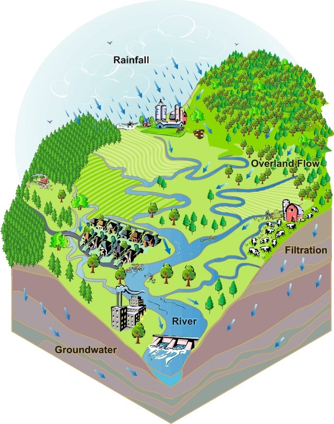
A watershed is the land area that drains to a body of water. Like puzzle pieces that fit together to create a larger picture, small creeks and streams have small watersheds that fit together along ridges and form larger watersheds or river basins.
Why are watersheds important?
Watersheds show us the connection between land and water. The topography of the landscape defines how water moves through it. Another term for watershed is hydrologic unit. The nature and quality of a waterbody reflects that of the land that drains to it.
What is your Watershed Address?
You probably already know which large river basin you live in, but do you know your small creek watershed? Just as cities and towns are located in counties and states, small watersheds are nested together to comprise larger river basins.
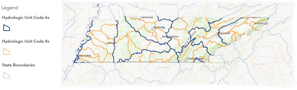
Hydrologic Unit Codes, or “HUCs,” are sequences of numbers used to describe watersheds in terms of scale. Large river basins (like the Mississippi River) are described with 2-digit HUCs. These 2-digit HUCs are comprised of river basins that are described with 4- and 6-digit HUCs. Small creeks and streams are described with 12-digit HUCs.
Just as your home has a physical mailing address with a street, city and state, it also and has a “watershed address” that reflects where your home lies in the mosaic of watersheds. Find your Tennessee Watershed Address (HUC12 watershed, and HUC8 river basin) with this interactive Story Map Activity. Find out more about Tennessee’s watersheds from the Tennessee Department of Environment and Conservation.
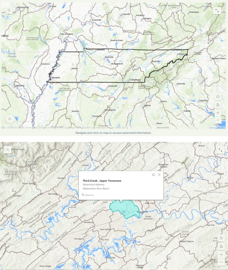
Find your “Watershed Address.“
1. Visit the Watersheds Story Map.
2. Use the locate button, search for street address in the search bar, or scroll to zoom in to your property.
3. Click on the map at location to open a box with information on your “Watershed Address.” If you mailing address is a City, State; then your Watershed Address is Creek Watershed, River Basin.
4. Share your Watershed Address with us! Add it to the dynamic Watershed Word Cloud.
Populate the Watershed Word Cloud.
The word cloud below is a compilation of all the watershed addresses entered here. Have your watersheds included by submitting them with one of these options:
By Text: Send a text to the number 22333. In the body of the text, type “aludwig001” and then just the watershed names, excluding “creek” and “river” and other descriptors like “Upper.” Example:
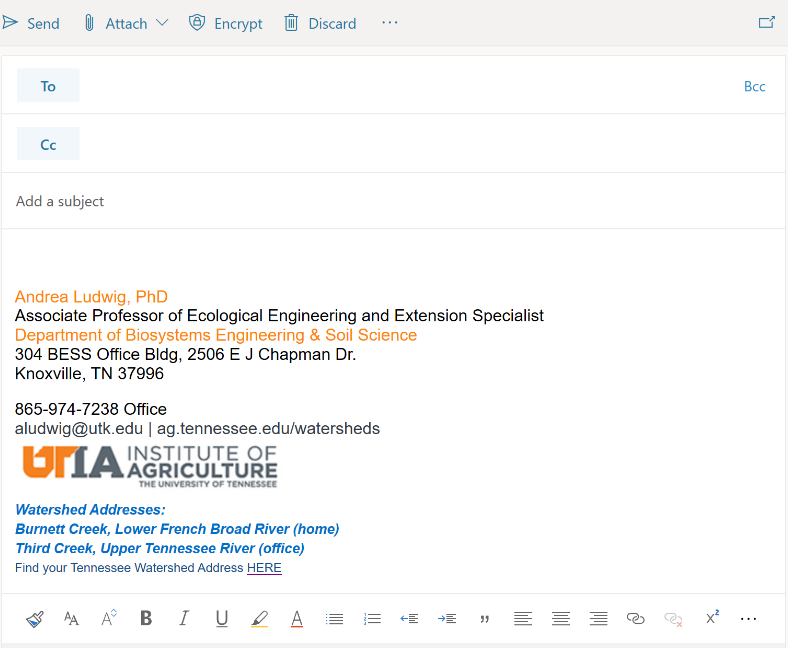
Watershed Address: Burnett Creek, French Broad River
Text: “aludwig001 Burnett FrenchBroad”
Or by Website: Enter each unique watershed name separately at the website.
Share with Others Your Watershed Address
Help raise awareness about watersheds by adding your “Watershed Address” to your email signature or letterhead, just as you include your physical mailing address.
Instructor Resources
Instructions for completing watershed word cloud activity with your group
Download printable watershed puzzle (below), cut along watershed boundaries (bold black lines). For groups that need hints, print two and use one as a basesheet.
Resources for Watershed and Water Quality Information:
- A Guide to Traveling Tennessee’s Watersheds (TN Dept of Environment & Conservation)
- How’s My Waterway (US Environmental Protection Agency)
- Wikiwatershed (Stroud Water Research Center)